Browse Items (79 items total)
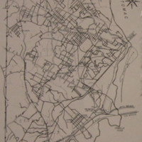
This 1920 map shows magisterial districts, communities, subdivisions, and rail and trolley lines in the booming county. In 1920 Arlington officially changed its not from Alexandria County to Arlington County. This separation from any association with the City of Alexandria recognized the county's formation of its own identity due to how quickly the county was growing.
Collection: Maps
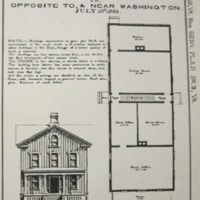
This plan for the Freedman's Village headquarters was created by the War Department in 1865. The government's continued investment in the Village and its infrastructure shows how even though the Village was created as a war aim, Freedman's Village continued to expand as an African American community in peace. The Four Square architectural style of the house was popular in Arlington and across the county in suburban landscapes of the late nineteenth century. The style is associated with early streetcar suburbs, like the ones which were just beginning to emerge in Arlington at the close of the Civil War.
Collection: Community Institutions
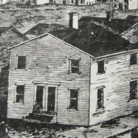
Freedman's Village was a contraband camp created by the War Department and strengthened by Arlington's African American community. The Village, located on the lands of Robert E. Lee's Arlington plantation, was a black neighborhood in Arlington from 1863 until 1900.
Here 100 white-washed, one-and-a-half story duplexes, like the one pictured, were constructed along a quarter-mile long thoroughfare through the Village. The clapboard houses used a paired-down version of the Classical Revival style. This housing type remained a popular choice for African American communities in Arlington throughout the early twentieth century.
Here 100 white-washed, one-and-a-half story duplexes, like the one pictured, were constructed along a quarter-mile long thoroughfare through the Village. The clapboard houses used a paired-down version of the Classical Revival style. This housing type remained a popular choice for African American communities in Arlington throughout the early twentieth century.
Collection: Neighborhoods
Johnson's Hill, today known as Arlington View, is an African American community located along Columbia Pike which first began ca. 1880. Here a tollgate was created at the intersection of Columbia Pike and the Georgetown-Alexandria Pike (today South Arlington Ridge Road). A small village center with houses, two stores, a post office, and a blacksmith shop formed around this tollgate, helping to expand and strengthen this African American community.
Collection: Neighborhoods
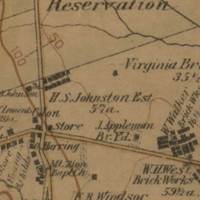
The Washington and Old Dominion Railroad (W&OD) was founded in 1900 as the Great Falls and Old Dominion Railroad. The steam-rail line began in Rosslyn and extended out to various Arlington neighborhoods, including Cherrydale (1904) and Great Falls (1906). The W&OD continued to expand beyond the county by connecting to the Great Falls and Bluemont lines at the Bon Air neighborhood junction. Their service to Great Falls was discontinued in the 1930s, when their right-of-way was transferred to become Old Dominion Drive. The Bluemont line was aquired by the Southern Railroad in 1944 and continued service until 1968. Today the former W&OD line is a popular biking path.
Trolley transportation helped to strengthen and expand Arlington's suburban environment at the turn of the century.
The stop featured in this photograph is the Alexandria Junction along present day Route 1.
Trolley transportation helped to strengthen and expand Arlington's suburban environment at the turn of the century.
The stop featured in this photograph is the Alexandria Junction along present day Route 1.
Collection: Neighborhoods
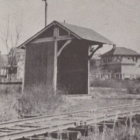
This steam railroad began as the Alexandria, Loudon, and Hampshire Railroad in the 1850s. The line ran from Alexandria City, up the Four Mile Run Valley, past the Glencarlyn neighborhood (whose stop is pictured) and out to Herndon, Leesburg, and Bluemont. In 1911 the line was taken over by the Washington and Old Dominion Railroad (W&OD) and converted to electric-rail the following year. The W&OD was in service until 1968.
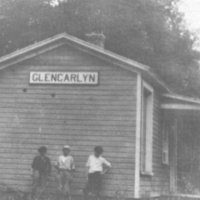
The Glencarlyn stop in pictured here. By 1900 trolley lines linked the new and expanding suburban communities of Glencarlym, Clarendon, Ballston, Cherrydale, Bon Air, and Barcroft. The rail became the fastest and most efficient way to travel within the county and beyond.
The Glencarlyn stop in pictured here. By 1900 trolley lines linked the new and expanding suburban communities of Glencarlym, Clarendon, Ballston, Cherrydale, Bon Air, and Barcroft. The rail became the fastest and most efficient way to travel within the county and beyond.
Collection: Neighborhoods
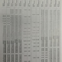
Originally called the Arlington Fairfax Line, this line began in 1896 as a horse-drawn line with stops at Rosslyn, Fort Myer, Clarendon, Ballston, Hall's Hill, and Falls Church. Throughout the early 1900s the line expanded to include service to Arlington National Cemetery, Columbia Pike, Green Valley, Vienna, and Fairfax. Expansion of trolley lines in Arlington at the turn of the century helped to expand and strengthen Arlington's emerging suburban environment. In the 1920s and 1930s Arlington residents began to transition to automobile transportation. After nearly a decade of financial troubles, the line officially stopped running in 1932.
This image shows one of the lines daily schedules.
This image shows one of the lines daily schedules.
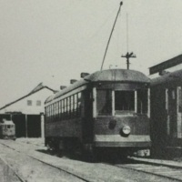
The Washington, Alexandria, and Mt. Vernon line was completed in 1894 and was operational until 1932. The route of this line traveled from Washington, D.C. along the Fourteenth Street Bridge, down Route 1 to Alexandria, and out to George Washington's Mount Vernon. This line serviced many neighborhoods, including the African American neighborhoods of East Arlington and Queen City. The line also ran to the Luna Park Amusement Park, which was owned and operated by Washington, Alexandria, and Mt. Vernon executives.
This image shows some of the lines' cars at their storage facility along Four Mile Run.
This image shows some of the lines' cars at their storage facility along Four Mile Run.
Collection: Neighborhoods
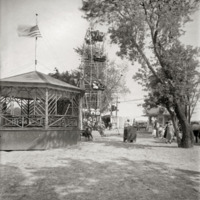
During the 1920s Arlington had a bathing beach on the Potomac River. The beach featured swimming, concessions, canoes, and a ferris wheel. Despite being located near the African American neighborhoods of East Arlington and Queen City, the Arlington Bathing Beach was segregated. Here you can see all-white bathers enjoying the facility. James "Jimmy" E. Taylor, who lived in Hall's Hill, said that black children swam in a "creek out on Route 50... called 'Blue Man Junction'" since more formal swimming locations were not open to them. The beach was closed down in 1929 to make way for expansions to Hoover Airport, today known as National Airport.
Collection: Community Institutions
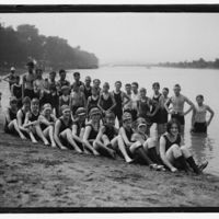
During the 1920s Arlington had a bathing beach along the Potomac River, near the present-day Pentagon. A 1923 brochure for the beach hoped to entice visitors from Washington by highlighting "parking facilities such as are seldom found." The beach featured swimming, concessions, canoes, and a ferris wheel. Despite being located near the African American neighborhoods of East Arlington and Queen City, the Arlington Bathing Beach was a segregated whites-only environment. It was closed down in 1929 to make way for expansions to Hoover Airport, today known as National Airport.
Collection: Community Institutions