Browse Items (20 items total)
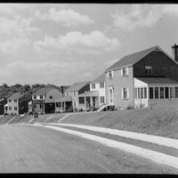
In 1942 the Office of War Information photographed suburban homes under construction in Arlington. Arlington saw a huge boom in building during the war years as civilian and military federal employees came to work in Washington and the newly constructed Pentagon. This housing boom profoundly changed the make up of Arlington.
Collection: Neighborhoods
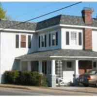
At Hunter Station the Fort Myer Branch of the Washington, Alexandria, and Falls Church commuter rail line met with trolley car lines. Hunter Station was located within the African American Butler-Holmes community, today called Penrose. With connections to Rosslyn, Georgetown, and downtown Washington, these lines helped to expand Butler-Holmes throughout the early twentieth century. The community was also served by the Columbia Station near present-day Columbia Pike and Walter Reed Drive, but the station's exact location is not known. Today Hunter Station is a private residence.
Collection: Neighborhoods
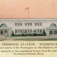
Rosslyn was a main commuter core for each of Arlington's trolley lines. The station connected lines from Virginia and the District in addition to serving as a hub for foot and bus traffic. These images show the inside (postcard) and outside (photograph) of the Rosslyn Terminal Station. The station was built by the Washington and Old Dominion railroad in 1923 when the line discontinued its service into Washington after eleven years. It remained in use until 1939, when the government acquired the land as part of the George Washington Memorial Parkway National Park site.
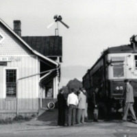
This image shows East Falls Church Station on May 31, 1951, the last day of passenger service. This stop was originally opened as a part of the Washington, Arlington & Falls Church line in 1901 and became a part of the Washington-Virginia Railroad in 1913. The line had been in financial trouble since the 1920s as commuters increasingly turned to automobiles for travel. After a brief resurgence in use and support during World War Two, the line finally ended its passenger service in 1951.
Collection: Neighborhoods
The Washington-Virginia line was formed by a merger of the Washington, Alexandria, and Mt Vernon and the Washington Alexandria and Mt Vernon railroads.
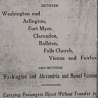
This advertisement for the Washington-Virginia Railway highlights the lines' many connections to the neighborhoods of Arlington and downtown Washington, D.C. The advertisement boasts how the new line is "within a few minutes walk to all Theatres, Government Buildings, Department Stores," and more. This list of attractions highlights the social, cultural, and employment amenities available to Arlington residents with the expansion and opening of the trolley lines during the early twentieth century. With this increased connection to D.C. and the desire to live within suburban, single family homes the "Fort Myer, Clarendon, Ballston, and Falls Church" communities and more all continued to grow.
This advertisement for the Washington-Virginia Railway highlights the lines' many connections to the neighborhoods of Arlington and downtown Washington, D.C. The advertisement boasts how the new line is "within a few minutes walk to all Theatres, Government Buildings, Department Stores," and more. This list of attractions highlights the social, cultural, and employment amenities available to Arlington residents with the expansion and opening of the trolley lines during the early twentieth century. With this increased connection to D.C. and the desire to live within suburban, single family homes the "Fort Myer, Clarendon, Ballston, and Falls Church" communities and more all continued to grow.
Collection: Neighborhoods
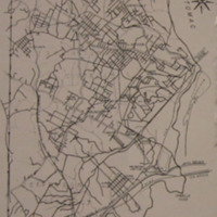
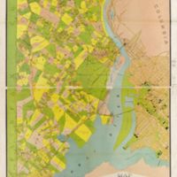
This 1920 map shows magisterial districts, communities, subdivisions, and rail and trolley lines in the booming county. In 1920 Arlington officially changed its not from Alexandria County to Arlington County. This separation from any association with the City of Alexandria recognized the county's formation of its own identity due to how quickly the county was growing.
Collection: Maps
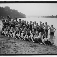
During the 1920s Arlington had a bathing beach on the Potomac River. The beach featured swimming, concessions, canoes, and a ferris wheel. Despite being located near the African American neighborhoods of East Arlington and Queen City, the Arlington Bathing Beach was segregated. Here you can see all-white bathers enjoying the facility. James "Jimmy" E. Taylor, who lived in Hall's Hill, said that black children swam in a "creek out on Route 50... called 'Blue Man Junction'" since more formal swimming locations were not open to them. The beach was closed down in 1929 to make way for expansions to Hoover Airport, today known as National Airport.
Collection: Community Institutions
During the 1920s Arlington had a bathing beach along the Potomac River, near the present-day Pentagon. A 1923 brochure for the beach hoped to entice visitors from Washington by highlighting "parking facilities such as are seldom found." The beach featured swimming, concessions, canoes, and a ferris wheel. Despite being located near the African American neighborhoods of East Arlington and Queen City, the Arlington Bathing Beach was a segregated whites-only environment. It was closed down in 1929 to make way for expansions to Hoover Airport, today known as National Airport.
Collection: Community Institutions
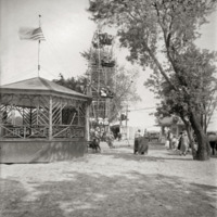
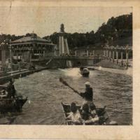
Luna Park was an amusement park in Arlington County in operation from 1906 to 1915.
The Park was owned and operated by the Washington, Alexandria, and Mt. Vernon Railway Company. The Company commissioned Ingersoll Company of Pittsburgh to build the park after Arlington Prosecutor Crandal Mackey closed Arlington's gambling houses. Fearing a drop off in patronage on their line, Luna Park was meant to act as a more family friendly draw. The Park featured water rides, side shows, and animal acts.
The architecture of the venue was Ionic. The style also had many international inspirations, including Egyptian, Byzantine, Moorish, Japanese, Arabic, Gothic, French, Renaissance, and Corinthian designs.
Like almost all recreation activities in Arlington at the time, Luna Park was segregated.
Collection: Community Institutions
This map of Arlington County, then called Alexandria County, highlights Arlington's growing real estate developments.At the turn of the century Arlington was fast becoming a suburban enclave of Washington, D.C. Nearly two-dozen communities expanded or were formed at this time. This development encouraged and was encouraged by further rail-line development into the area.
Collection: Maps
