Browse Items (8 items total)
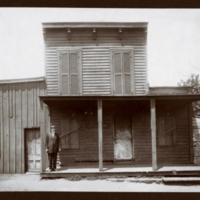
The League was a loosely organized social and political organization comprised of about twenty of the county's wealthiest and most prominent residents - including William Ball, Crandal Mackey, and Frank Lyon. Many of their aims centered on bringing more municipal improvements to the county, as a part of the broader Southern Progressive Movement. The group famously armed themselves and attacked saloons in Rosslyn on May 30, 1904 in an effort to rid the county of institutions and individuals they deemed undesirable. Here, Mackey stands on the porch of a saloon.
Collection: Community Institutions
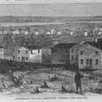
This woodcut, featured in Harper's Weekly in 1864, depicts Freedman's Village. A contraband camp established on the grounds of Arlington House, Robert E. Lee's plantation, Freedman's Village was Arlington's first all black community as well as its first successful pre-planned community. Here formerly enslaved men, women, and children learned trades, attended school, established churches, and create a thriving African American community. When the Village was formally closed by the federal government in 1900 it lead to the establishment of many other black communities in Arlington through the Freedman's Village diaspora.
Collection: Neighborhoods
In 1861 the Fort Barnard Fortifications were constructed as part of the Civil War defenses of Washington in Green Valley. The fort was named for General J.G. Barnard, the chief engineer for the defenses of Washington. The fort had significant earth works and gun platforms which featured twelve 24-32 pounder guns. During the war the fort was occupied by the 3rd Artillery Battery of the New York and the 14th of Massachusetts.
In 1902 the site was preserved as a park and community playground.
In 1902 the site was preserved as a park and community playground.
Collection: Community Institutions
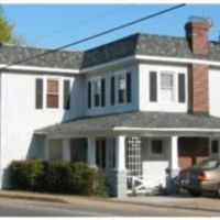
At Hunter Station the Fort Myer Branch of the Washington, Alexandria, and Falls Church commuter rail line met with trolley car lines. Hunter Station was located within the African American Butler-Holmes community, today called Penrose. With connections to Rosslyn, Georgetown, and downtown Washington, these lines helped to expand Butler-Holmes throughout the early twentieth century. The community was also served by the Columbia Station near present-day Columbia Pike and Walter Reed Drive, but the station's exact location is not known. Today Hunter Station is a private residence.
Collection: Neighborhoods
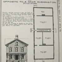
This plan for the Freedman's Village headquarters was created by the War Department in 1865. The government's continued investment in the Village and its infrastructure shows how even though the Village was created as a war aim, Freedman's Village continued to expand as an African American community in peace. The Four Square architectural style of the house was popular in Arlington and across the county in suburban landscapes of the late nineteenth century. The style is associated with early streetcar suburbs, like the ones which were just beginning to emerge in Arlington at the close of the Civil War.
Collection: Community Institutions
Freedman's Village was a contraband camp created by the War Department and strengthened by Arlington's African American community. The Village, located on the lands of Robert E. Lee's Arlington plantation, was a black neighborhood in Arlington from 1863 until 1900.
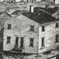
Here 100 white-washed, one-and-a-half story duplexes, like the one pictured, were constructed along a quarter-mile long thoroughfare through the Village. The clapboard houses used a paired-down version of the Classical Revival style. This housing type remained a popular choice for African American communities in Arlington throughout the early twentieth century.
Here 100 white-washed, one-and-a-half story duplexes, like the one pictured, were constructed along a quarter-mile long thoroughfare through the Village. The clapboard houses used a paired-down version of the Classical Revival style. This housing type remained a popular choice for African American communities in Arlington throughout the early twentieth century.
Collection: Neighborhoods
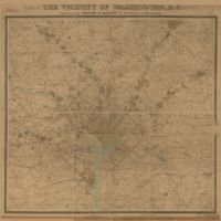
This map shows Arlington County as well as the District of Columbia and neighboring Virginia and Maryland counties. In the years after the Civil War, Arlington neighborhoods and trolley lines continued to form and expand. Increasingly these developments moved away from piecemeal, individual home building and toward large, centrally planned community developments.
Collection: Maps
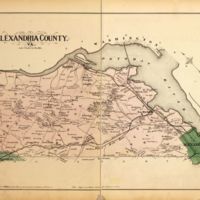
This 1878 map of Arlington County, then called Alexandria County, shows growing neighborhoods and trolley line development following the Civil War as the area transitioned from rural farmland to a more suburban environment.
Collection: Maps
